
| Distance / Altitude | Location | Report Date / Time | Live Weather | Wind | Gusts | Temp. | Visibility | Cloud |
|---|---|---|---|---|---|---|---|---|
| 8.1 miles N / 10 ft | BUOY-CWBF1 (Marine) | 2025-04-01 17:48 local (2025/04/01 21:48 GMT) | light winds from the SSW (5 mph at 210) | — | - | |||
| 9.3 miles NNE / 72 ft | Clearwater Airport (Florida) (Florida) | 2025-04-01 17:35 local (2025/04/01 21:35 GMT) | Clear | light winds from the WSW (5 mph at 250) | 78.8°F | 16 | ||
| 10.6 miles ENE / 715 ft | ST Petersburg Airport (Florida) | 2025-04-01 16:53 local (2025/04/01 20:53 GMT) | Clear | light winds from the W.(Wind varies from 230 to 310 degs) (10 mph at 260) | 87.1°F | 16 | ||
| 14.9 miles ESE / 715 ft | St Peters/Albert Whitted Airport (Florida) | 2025-04-01 16:53 local (2025/04/01 20:53 GMT) | - | light winds from the W (10 mph at 280) | 80.1°F | 16 | ||
| 15.5 miles ESE / 10 ft | BUOY-SAPF1 (Marine) | 2025-04-01 17:48 local (2025/04/01 21:48 GMT) | light winds from the W (10 mph at 280) | — | - | |||
| 18.6 miles E / 10 ft | BUOY-OPTF1 (Marine) | 2025-04-01 17:48 local (2025/04/01 21:48 GMT) | light winds from the WSW (10 mph at 250) | — | - | |||
| 19.9 miles S / 10 ft | Egmont Channel Entrance- FL (Marine) | 2025-04-01 17:56 local (2025/04/01 21:56 GMT) | - (- mph at -) | — | - | |||
| 20.5 miles E / 696 ft | MacDill Air Force Base/Tampa Airport (Florida) | 2025-04-01 16:55 local (2025/04/01 20:55 GMT) | Clear | light winds from the SSW (10 mph at 210) | 82.9°F | 16 | ||
| 20.5 miles ENE / 715 ft | Tampa Airport (Florida) | 2025-04-01 16:53 local (2025/04/01 20:53 GMT) | Dry and partly cloudy | light winds from the SSW (5 mph at 210) | 84.9°F | 16 | few scattered | |
| 21.1 miles SE / 10 ft | BUOY-MTBF1 (Marine) | 2025-04-01 17:48 local (2025/04/01 21:48 GMT) | light winds from the NW (10 mph at 310) | — | 10.9 |
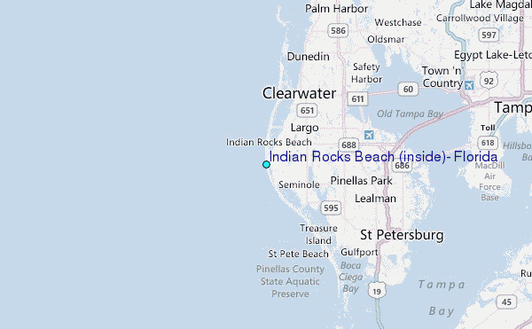
Choose Indian Rocks Beach (inside), Florida Location Map Zoom:
| Contours: | Roads & Rivers: | Select a
tide station / surf break / city |


Use this relief map to navigate to tide stations, surf breaks and cities that are in the area of Indian Rocks Beach (inside), Florida.
Other Nearby Locations' tide tables and tide charts to Indian Rocks Beach (inside), Florida:
click location name for more details
 Surf breaks close to Indian Rocks Beach (inside), Florida:
|
||
|---|---|---|
| Closest surf break | Indian Rocks Beach | 1 mi |
| Second closest surf break | Bellair Beach | 2 mi |
| Third closest surf break | Redington Breakwater | 3 mi |
| Fourth closest surf break | Sand Key Jetty | 4 mi |
| Fifth closest surf break | Clearwater Beach | 6 mi |

 Nearest