
| Distance / Altitude | Location | Report Date / Time | Live Weather | Wind | Gusts | Temp. | Visibility | Cloud |
|---|---|---|---|---|---|---|---|---|
| 6 km SW / 215 m | Brunei International Airport (Malaysia) | 2025-12-19 17:30 local (2025/12/19 09:30 GMT) | - | light winds from the NW (7 km/h at 320) | 30°C | 10.0 | few few broken | |
| 50 km NE / 213 m | Labuan Air Force Base Airport (Malaysia) | 2025-12-19 17:00 local (2025/12/19 09:00 GMT) | - | light winds from the N (6 km/h at 1) | 30°C | 10.0 | few few | |
| 51 km NE / 30 m | Labuan (Malaysia) | 2025-12-19 17:00 local (2025/12/19 09:00 GMT) | - | light winds from the NNW (6 km/h at 330) | 30°C | 45 km | - mostly cloudy - | |
| 126 km E / 943 m | lightning 23km SSW of Keningau (Malaysia) | 2025-12-19 18:21 local (2025/12/19 10:21 GMT) | Thunderstorm | (- km/h at -) | — | |||
| 128 km SW / 129 m | Miri (Malaysia) | 2025-12-19 17:00 local (2025/12/19 09:00 GMT) | Clouds developing | light winds from the NNW (9 km/h at 330) | 31°C | 50 km | mostly cloudy | |
| 130 km SW / 213 m | Miri Airport (Malaysia) | 2025-12-19 17:00 local (2025/12/19 09:00 GMT) | Dry and partly cloudy | light winds from the NNW.(Wind varies from 240 to 050 degs) (9 km/h at 330) | 31°C | 10.0 | scattered scattered scattered | |
| 161 km SSE / 1019 m | lightning 136km SE of Bangar (Brunei Darussalam) | 2025-12-19 17:50 local (2025/12/19 09:50 GMT) | Thunderstorm | (- km/h at -) | — | |||
| 163 km NE / 3 m | Kota Kinabalu International Airport (Malaysia) | 2025-12-19 17:00 local (2025/12/19 09:00 GMT) | Thunderstorms | light winds from the ENE (6 km/h at 70) | 30°C | 44 km | mostly cloudy | |
| 163 km NE / 3 m | Kota Kinabalu International Airport (Malaysia) | 2025-12-19 17:30 local (2025/12/19 09:30 GMT) | Thunderstorm - | wind obs. (7 kph from 140 degs) was rejected (- km/h at -) | 30°C | 10.0 | few few - | |
| 288 km SSW / 130 m | Bintulu Airport (Malaysia) | 2025-12-19 17:00 local (2025/12/19 09:00 GMT) | Clouds dissolving | light winds from the NNW (11 km/h at 340) | 31°C | 50 km | mostly cloudy |
| Contours: | Roads & Rivers: | Select a
tide station / surf break / city |


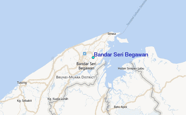
Use this relief map to navigate to tide stations, surf breaks and cities that are in the area of Bandar Seri Begawan.
Other Nearby Locations' tide tables and tide charts to Bandar Seri Begawan:
click location name for more details
 Surf breaks close to Bandar Seri Begawan:
|
||
|---|---|---|
| Closest surf break | Berakas Beach | 6 mi |
| Second closest surf break | Tungku Beach or KM26 | 7 mi |
| Third closest surf break | Tanjung Batu | 10 mi |
| Fourth closest surf break | Pulau Manukan | 101 mi |
| Fifth closest surf break | Tanjung Aru Beach | 101 mi |


 Nearest