
| Distance / Altitude | Location | Report Date / Time | Live Weather | Wind | Gusts | Temp. | Visibility | Cloud |
|---|---|---|---|---|---|---|---|---|
| 1.9 miles N / 10 ft | BUOY-WYCM6 (Marine) | 2025-04-24 21:00 local (2025/04/25 02:00 GMT) | moderate winds from the SSE (15 mph at 150) | 82.6°F | - | |||
| 8.1 miles W / 1283 ft | Bay St Louis Airport (Mississippi) | 2025-04-24 19:47 local (2025/04/25 00:47 GMT) | Dry and partly cloudy | light winds from the SSE (5 mph at 150) | 75.2°F | 16 | scattered | |
| 9.3 miles ENE / 23 ft | Long Beach (Mississippi) | 2025-04-24 21:43 local (2025/04/25 02:43 GMT) | dry | calm (0 mph at 109) | 75.2°F | - | - - 0 | |
| 16.8 miles ENE / 686 ft | Gulfport Airport (Mississippi) | 2025-04-24 20:42 local (2025/04/25 01:42 GMT) | Dry and partly cloudy | light winds from the SE (10 mph at 140) | 77.0°F | 16 | scattered scattered broken | |
| 19.9 miles NE / 75 ft | Gulfport (Mississippi) | 2025-04-24 21:47 local (2025/04/25 02:47 GMT) | - | calm (0 mph at 106) | 69.8°F | - | - - 0 | |
| 25.5 miles ENE / 715 ft | Biloxi/Keesler Airport (Mississippi) | 2025-04-24 20:35 local (2025/04/25 01:35 GMT) | Dry and partly cloudy | light winds from the SSE.(Wind varies from 014 to 022 degs) (5 mph at 160) | 77.0°F | 16 | broken broken | |
| 25.5 miles NW / 190 ft | Caesar wx (United States) | 2025-04-24 21:20 local (2025/04/25 02:20 GMT) | dry | calm (0 mph at 115) | 69.8°F | - | - - 0 | |
| 26.1 miles WSW / 16 ft | Heritage Subdivision wx (United States) | 2025-04-24 21:29 local (2025/04/25 02:29 GMT) | dry | calm (0 mph at 172) | 73.4°F | - | - - 0 | |
| 26.1 miles WSW / 16 ft | Pine Shadows wx (United States) | 2025-04-24 21:16 local (2025/04/25 02:16 GMT) | dry | calm (0 mph at 135) | 73.4°F | - | - - 0 | |
| 26.1 miles WSW / 16 ft | Slidell (Louisiana) | 2025-04-24 21:42 local (2025/04/25 02:42 GMT) | dry | calm (5 mph at 139) | 73.4°F | - | - - 0 |
| Contours: | Roads & Rivers: | Select a
tide station / surf break / city |


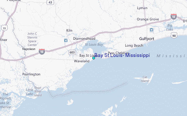
Use this relief map to navigate to tide stations, surf breaks and cities that are in the area of Bay St Louis, Mississippi.
Other Nearby Locations' tide tables and tide charts to Bay St Louis, Mississippi:
click location name for more details
 Surf breaks close to Bay St Louis, Mississippi:
|
||
|---|---|---|
| Closest surf break | Chandeleur Islands | 44 mi |
| Second closest surf break | Dauphin Island Pier | 75 mi |
| Third closest surf break | West Pass | 95 mi |
| Fourth closest surf break | Terry s Cove | 104 mi |
| Fifth closest surf break | Alabama Point | 106 mi |

 Nearest