
| Distance / Altitude | Location | Report Date / Time | Live Weather | Wind | Gusts | Temp. | Visibility | Cloud |
|---|---|---|---|---|---|---|---|---|
| 62 km ENE / 1383 m | Mahabaleshwar (India) | 2025-12-19 14:30 local (2025/12/19 09:00 GMT) | - | light winds from the ENE (19 km/h at 70) | 23°C | 10 km | few | |
| 94 km SSE / 210 m | Ratnagiri (India) | 2025-12-19 14:30 local (2025/12/19 09:00 GMT) | Clouds developing | light winds from the NW (9 km/h at 320) | 32°C | 4 km | scattered | |
| 114 km NE / 558 m | Pune (India) | 2025-12-19 14:30 local (2025/12/19 09:00 GMT) | - | light winds from the E (9 km/h at 90) | 28°C | 10 km | clear | |
| 125 km NW / 11 m | Colaba - Mumbai (India) | 2025-12-19 14:30 local (2025/12/19 09:00 GMT) | Haze | calm (4 km/h at 290) | 31°C | 2 km | few | |
| 148 km N / 195 m | Bombay/Santacruz Airport (India) | 2025-12-19 15:00 local (2025/12/19 09:30 GMT) | - | moderate winds from the W (20 km/h at 260) | — | 3.0 | ||
| 148 km N / 15 m | BombaySantacruz (India) | 2025-12-19 14:30 local (2025/12/19 09:00 GMT) | Visibility reduced by smoke | light winds from the NW (7 km/h at 320) | 31°C | 2 km | - clear - | |
| 149 km NW / 4 m | Mumbai Juhu Airport (India) | 2025-12-19 15:00 local (2025/12/19 09:30 GMT) | - | light winds from the W (13 km/h at 260) | — | 5.0 | ||
| 171 km SE / 570 m | Kolhapur (Chhatrapati Rajaram Maharaj Airport) (India) | 2025-12-19 14:30 local (2025/12/19 09:00 GMT) | Dry and partly cloudy | light winds from the ENE (19 km/h at 60) | 29°C | 6.0 | no significant cloud scattered - | |
| 243 km N / 4 m | Dahanu (India) | 2025-12-19 14:30 local (2025/12/19 09:00 GMT) | - | light winds from the NNW (7 km/h at 340) | 30°C | 4 km | clear | |
| 249 km NNE / 587 m | Shirdi Airport (India) | 2025-12-19 15:00 local (2025/12/19 09:30 GMT) | - | light winds from the NNE (6 km/h at 20) | — | 5.0 |

| Contours: | Roads & Rivers: | Select a
tide station / surf break / city |


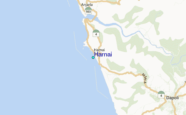
Use this relief map to navigate to tide stations, surf breaks and cities that are in the area of Harnai.
Other Nearby Locations' tide tables and tide charts to Harnai:
click location name for more details
 Surf breaks close to Harnai:
|
||
|---|---|---|
| Closest surf break | Arambol | 152 mi |
| Second closest surf break | Morjim Beach | 156 mi |
| Third closest surf break | Betalbatim Beach Taj | 181 mi |
| Fourth closest surf break | Benaulim Beach | 184 mi |
| Fifth closest surf break | Agonda | 200 mi |


 Nearest