
| Distance / Altitude | Location | Report Date / Time | Live Weather | Wind | Gusts | Temp. | Visibility | Cloud |
|---|---|---|---|---|---|---|---|---|
| 9.3 miles S / 80 ft | Ipswich (Massachusetts) | 2025-04-11 05:06 local (2025/04/11 09:06 GMT) | - | calm (0 mph at 1) | 35.6°F | - | - - 0 | |
| 14.3 miles SSW / 715 ft | Lawrence Airport (Massachusetts) | 2025-04-11 05:25 local (2025/04/11 09:25 GMT) | Light rain | light winds from the E.(Wind varies from 005 to 011 degs) (5 mph at 100) | 35.1°F | 13 | broken overcast | |
| 15.5 miles NNE / 10 ft | BUOY-BGXN3 (Marine) | 2025-04-11 04:45 local (2025/04/11 08:45 GMT) | calm (0 mph at 200) | 34.9°F | - | |||
| 16.2 miles NNE / 715 ft | Portsmouth/Pease Airport (New Hampshire) | 2025-04-11 04:55 local (2025/04/11 08:55 GMT) | Light rain | calm (0 mph at 0) | 35.6°F | 13 | scattered overcast | |
| 17.4 miles S / 715 ft | Beverly Airport (Massachusetts) | 2025-04-11 05:16 local (2025/04/11 09:16 GMT) | Light rain | light winds from the SE (5 mph at 130) | 35.1°F | 16 | broken overcast | |
| 17.4 miles ENE / 10 ft | BUOY-IOSN3 (Marine) | 2025-04-11 06:00 local (2025/04/11 10:00 GMT) | light winds from the S (10 mph at 180) | 36.3°F | - | |||
| 18.6 miles S / 82 ft | Beverly (Massachusetts) | 2025-04-11 04:09 local (2025/04/11 08:09 GMT) | - | calm (0 mph at 158) | 35.6°F | - | - - 0 | |
| 18.6 miles NNE / 10 ft | BUOY-SEIM1 (Marine) | 2025-04-11 05:30 local (2025/04/11 09:30 GMT) | - (- mph at -) | 35.6°F | - | |||
| 19.3 miles S / 49 ft | Beverly (Massachusetts) | 2025-04-11 04:13 local (2025/04/11 08:13 GMT) | dry | calm (0 mph at 180) | 37.4°F | - | - - 0 | |
| 21.1 miles NNE / 49 ft | SHIP10652 (Marine) | 2025-04-11 04:00 local (2025/04/11 08:00 GMT) | light winds from the S (5 mph at 180) | 44.1°F | - km |

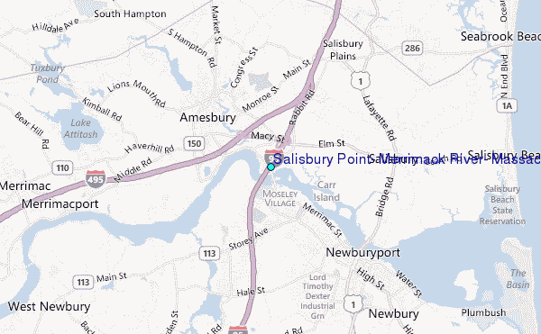
Choose Salisbury Point, Merrimack River, Massachusetts Location Map Zoom:
| Contours: | Roads & Rivers: | Select a
tide station / surf break / city |


Use this relief map to navigate to tide stations, surf breaks and cities that are in the area of Salisbury Point, Merrimack River, Massachusetts.
Other Nearby Locations' tide tables and tide charts to Salisbury Point, Merrimack River, Massachusetts:
click location name for more details
 Surf breaks close to Salisbury Point, Merrimack River, Massachusetts:
|
||
|---|---|---|
| Closest surf break | Salisbury Beach | 5 mi |
| Second closest surf break | Plum Island | 6 mi |
| Third closest surf break | Seabrook Beach | 6 mi |
| Fourth closest surf break | Hampton Beach | 7 mi |
| Fifth closest surf break | The Wall | 9 mi |

 Nearest