
| Distance / Altitude | Location | Report Date / Time | Live Weather | Wind | Gusts | Temp. | Visibility | Cloud |
|---|---|---|---|---|---|---|---|---|
| 6.8 miles SE / 10 ft | BUOY-WASD2 (Marine) | 2025-04-14 13:30 local (2025/04/14 17:30 GMT) | light winds from the S (5 mph at 180) | 66.2°F | - | |||
| 7.5 miles SE / 715 ft | Washington/National Airport (Washington D.c.) | 2025-04-14 12:52 local (2025/04/14 16:52 GMT) | - | light winds from the S (10 mph at 190) | 70.0°F | 16 | few few | |
| 8.7 miles SSE / 36 ft | Alexandria (Virginia) | 2025-04-14 13:45 local (2025/04/14 17:45 GMT) | dry | wind obs. (8 kph from 248 degs) was rejected (- mph at -) | 78.8°F | - | - - 0 | |
| 11.2 miles ENE / 49 ft | College Park Airport (Maryland) (Maryland) | 2025-04-14 13:25 local (2025/04/14 17:25 GMT) | Clear | light winds from the SSE (5 mph at 160) | 71.2°F | 16 | ||
| 14.9 miles S / 715 ft | Fort Belvoir/Davison Airport (Virginia) | 2025-04-14 12:55 local (2025/04/14 16:55 GMT) | Clear | light winds from the SSE (5 mph at 160) | 69.4°F | 16 | ||
| 15.5 miles ESE / 712 ft | Andrews Air Force Base Airport (Maryland) | 2025-04-14 12:55 local (2025/04/14 16:55 GMT) | Clear | light winds from the SW (10 mph at 230) | 70.9°F | 16 | ||
| 16.2 miles N / 541 ft | Gaithersburg Airport (Maryland) (Maryland) | 2025-04-14 12:56 local (2025/04/14 16:56 GMT) | - | light winds from the SE (10 mph at 140) | 70.0°F | 16 | few | |
| 18.0 miles WSW / 715 ft | Wash DC/Dulles Airport (Virginia) | 2025-04-14 12:52 local (2025/04/14 16:52 GMT) | Dry and partly cloudy | light winds from the SW (10 mph at 220) | 69.1°F | 16 | few scattered broken | |
| 21.7 miles ENE / 591 ft | Fort Meade Airport (Maryland) | 2025-04-14 13:29 local (2025/04/14 17:29 GMT) | Clear | light winds from the SW (5 mph at 220) | 69.8°F | 16 | ||
| 24.2 miles ESE / 10 ft | BUOY-BSLM2 (Marine) | 2025-04-14 13:30 local (2025/04/14 17:30 GMT) | light winds from the SE (10 mph at 140) | 68.9°F | - |

| Contours: | Roads & Rivers: | Select a
tide station / surf break / city |
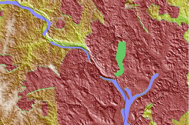
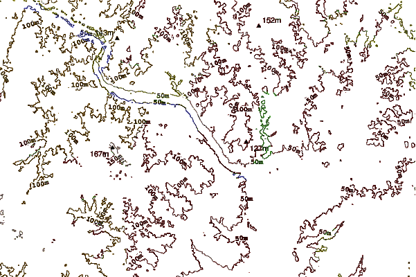
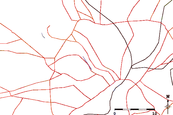
Use this relief map to navigate to tide stations, surf breaks and cities that are in the area of Chain Bridge, DC.
Other Nearby Locations' tide tables and tide charts to Chain Bridge, DC:
click location name for more details
 Surf breaks close to Chain Bridge, DC:
|
||
|---|---|---|
| Closest surf break | Naval Jetties | 110 mi |
| Second closest surf break | The Cove Delaware | 110 mi |
| Third closest surf break | Rehoboth Main | 111 mi |
| Fourth closest surf break | Dewey Beach | 111 mi |
| Fifth closest surf break | Tower Road | 112 mi |

 Nearest