
| Distance / Altitude | Location | Report Date / Time | Live Weather | Wind | Gusts | Temp. | Visibility | Cloud |
|---|---|---|---|---|---|---|---|---|
| 13.7 miles ENE / 125 ft | Debert (Nova scotia) | 2025-04-10 19:00 local (2025/04/10 22:00 GMT) | - | light winds from the WSW (5 mph at 240) | — | 0.0 | - - - | |
| 17.4 miles E / 52 ft | Lower Onslow wx (Canada) | 2025-04-10 19:11 local (2025/04/10 22:11 GMT) | dry | light winds from the WSW (5 mph at 254) | 37.4°F | - | - - 0 | |
| 29.8 miles WSW / 102 ft | Parrsboro- NS (Canada) | 2025-04-10 19:00 local (2025/04/10 22:00 GMT) | - | light winds from the W (5 mph at 260) | — | - | - | |
| 32.9 miles SSW / 328 ft | Wolfville (Nova Scotia) | 2025-04-10 19:48 local (2025/04/10 22:48 GMT) | dry | calm (0 mph at 266) | 39.2°F | - | - - 0 | |
| 35.4 miles SSE / 476 ft | HalifaxIntl A- NS (Canada) | 2025-04-10 19:00 local (2025/04/10 22:00 GMT) | - | moderate winds from the SSW (15 mph at 210) | — | 44 km | - scattered - | |
| 36.0 miles WNW / 66 ft | Nappan (Nova scotia) | 2025-04-10 19:30 local (2025/04/10 22:30 GMT) | - | light winds from the SW (10 mph at 220) | — | 0.0 | - - - | |
| 36.0 miles SSE / 712 ft | Halifax International Airport (Nova Scotia) | 2025-04-10 18:00 local (2025/04/10 21:00 GMT) | Dry and partly cloudy | moderate winds from the SW (15 mph at 220) | 41.0°F | 24 | few scattered | |
| 41.6 miles SW / 161 ft | Kentville (Canada) | 2025-04-10 18:50 local (2025/04/10 21:50 GMT) | - | calm (0 mph at 60) | — | - | - | |
| 41.6 miles S / 256 ft | Middle Sackville wx (Canada) | 2025-04-10 19:35 local (2025/04/10 22:35 GMT) | dry | light winds from the SW (5 mph at 215) | 41.0°F | - | - - 0 | |
| 42.3 miles SW / 669 ft | Kentville Airport (Nova Scotia) | 2025-04-10 18:00 local (2025/04/10 21:00 GMT) | - | light winds from the W (10 mph at 260) | 42.8°F | 0.0 | - no observation - |

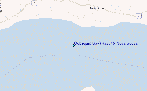
Choose Cobequid Bay (Ray0.4), Nova Scotia Location Map Zoom:
| Contours: | Roads & Rivers: | Select a
tide station / surf break / city |


Use this relief map to navigate to tide stations, surf breaks and cities that are in the area of Cobequid Bay (Ray0.4), Nova Scotia.
Other Nearby Locations' tide tables and tide charts to Cobequid Bay (Ray0.4), Nova Scotia:
click location name for more details
 Surf breaks close to Cobequid Bay (Ray0.4), Nova Scotia:
|
||
|---|---|---|
| Closest surf break | Backyards | 53 mi |
| Second closest surf break | Lawrencetown Reef | 53 mi |
| Third closest surf break | Lawrencetown Right Point | 53 mi |
| Fourth closest surf break | Minutes | 53 mi |
| Fifth closest surf break | Cow Bay | 54 mi |

 Nearest