
| Distance / Altitude | Location | Report Date / Time | Live Weather | Wind | Gusts | Temp. | Visibility | Cloud |
|---|---|---|---|---|---|---|---|---|
| 1.9 miles NNE / 10 ft | BUOY-PVDR1 (Marine) | 2025-04-01 21:30 local (2025/04/02 01:30 GMT) | light winds from the NW (10 mph at 320) | 46.6°F | 10.9 | |||
| 3.1 miles N / 10 ft | BUOY-FOXR1 (Marine) | 2025-04-01 21:30 local (2025/04/02 01:30 GMT) | moderate winds from the NNW (15 mph at 330) | 47.3°F | - | |||
| 3.7 miles SSW / 715 ft | Providence/Theodore Francis Green State Airport (Rhode Island) | 2025-04-01 20:51 local (2025/04/02 00:51 GMT) | Clear | light winds from the NW (10 mph at 320) | 46.9°F | 16 | ||
| 3.7 miles SE / 10 ft | BUOY-CPTR1 (Marine) | 2025-04-01 21:30 local (2025/04/02 01:30 GMT) | fresh winds from the NW (20 mph at 320) | 46.6°F | - | |||
| 8.7 miles SSE / 10 ft | BUOY-PTCR1 (Marine) | 2025-04-01 21:30 local (2025/04/02 01:30 GMT) | light winds from the N (5 mph at 360) | 46.4°F | - | |||
| 8.7 miles SSE / 10 ft | BUOY-NAXR1 (Marine) | 2025-04-01 20:45 local (2025/04/02 00:45 GMT) | light winds from the NNE (5 mph at 30) | 46.0°F | - | |||
| 10.6 miles S / 10 ft | BUOY-PDVR1 (Marine) | 2025-04-01 21:30 local (2025/04/02 01:30 GMT) | light winds from the NW (5 mph at 310) | 46.8°F | - | |||
| 11.2 miles S / 896 ft | Nort Kingston/Quonset State Airport (Rhode Island) | 2025-04-01 20:50 local (2025/04/02 00:50 GMT) | Clear | light winds from the NNW (10 mph at 330) | 46.4°F | 16 | ||
| 11.2 miles NE / 177 ft | Briggs Corner wx (United States) | 2025-04-01 21:11 local (2025/04/02 01:11 GMT) | dry | calm (0 mph at 89) | 42.8°F | - | - - 0 | |
| 11.8 miles ESE / 10 ft | BUOY-FRXM3 (Marine) | 2025-04-01 21:30 local (2025/04/02 01:30 GMT) | - (- mph at -) | 47.7°F | 10.9 |
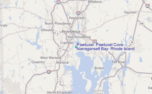
Choose Pawtuxet, Pawtuxet Cove, Narragansett Bay, Rhode Island Location Map Zoom:
| Contours: | Roads & Rivers: | Select a
tide station / surf break / city |


Use this relief map to navigate to tide stations, surf breaks and cities that are in the area of Pawtuxet, Pawtuxet Cove, Narragansett Bay, Rhode Island.
Other Nearby Locations' tide tables and tide charts to Pawtuxet, Pawtuxet Cove, Narragansett Bay, Rhode Island:
click location name for more details
 Surf breaks close to Pawtuxet, Pawtuxet Cove, Narragansett Bay, Rhode Island:
|
||
|---|---|---|
| Closest surf break | Bonnet Shores Point | 19 mi |
| Second closest surf break | Eastons Beach (1st Beach) | 20 mi |
| Third closest surf break | 2nd Beach | 20 mi |
| Fourth closest surf break | Bonnet Point | 21 mi |
| Fifth closest surf break | Sachuest Beach (2nd Beach) | 21 mi |

 Nearest