
| Distance / Altitude | Location | Report Date / Time | Live Weather | Wind | Gusts | Temp. | Visibility | Cloud |
|---|---|---|---|---|---|---|---|---|
| 20.5 miles SSW / 112 ft | MiramichiRcs-NB (Canada) | 2025-04-16 18:00 local (2025/04/16 21:00 GMT) | - | moderate winds from the W (10 mph at 270) | 48.6°F | - | no observation | |
| 20.5 miles SSW / 102 ft | Chatham (Canada) | 2025-04-16 17:50 local (2025/04/16 20:50 GMT) | no report | calm (0 mph at 150) | 33.3°F | - | - | |
| 27.3 miles WNW / 407 ft | RedPines-NB (Canada) | 2025-04-16 18:00 local (2025/04/16 21:00 GMT) | - | calm (0 mph at 260) | — | - | - no observation - | |
| 29.2 miles SSE / 112 ft | Kouchibouguac Cs- NB (Canada) | 2025-04-16 18:00 local (2025/04/16 21:00 GMT) | No report | calm (0 mph at 250) | 45.9°F | - | - no observation - | |
| 41.0 miles WNW / 712 ft | Bathurst Airport (New Brunswick) | 2025-04-16 17:00 local (2025/04/16 20:00 GMT) | Dry and cloudy | calm (0 mph at 0) | 41.0°F | 14 | broken broken overcast | |
| 41.6 miles WNW / 194 ft | Bathurst Airport (Canada) | 2025-04-16 18:00 local (2025/04/16 21:00 GMT) | no report | light winds from the W (5 mph at 280) | 42.1°F | 36 km | - overcast - | |
| 44.1 miles NNE / 16 ft | Bas Caraquet- NB (Canada) | 2025-04-16 18:00 local (2025/04/16 21:00 GMT) | no report | light winds from the W (5 mph at 280) | 39.9°F | - | - no observation - | |
| 54.1 miles E / 712 ft | North Point Airport (Prince Edward Islan) | 2025-04-16 17:00 local (2025/04/16 20:00 GMT) | - | light winds from the E (5 mph at 100) | 39.2°F | 0.0 | ||
| 54.7 miles E / 26 ft | NorthCape-Pei (Canada) | 2025-04-16 18:00 local (2025/04/16 21:00 GMT) | - | wind obs. (36 kph from 220 degs) was rejected (- mph at -) | — | - | - no observation - | |
| 56.5 miles N / 151 ft | New Carlisle 1- Que (Canada) | 2025-04-16 18:00 local (2025/04/16 21:00 GMT) | - | light winds from the W (5 mph at 280) | — | - | - no observation - |

Choose Portage Island, off Prince Edward Island Location Map Zoom:
| Contours: | Roads & Rivers: | Select a
tide station / surf break / city |


Use this relief map to navigate to tide stations, surf breaks and cities that are in the area of Portage Island, off Prince Edward Island.
Other Nearby Locations' tide tables and tide charts to Portage Island, off Prince Edward Island:
click location name for more details
 Surf breaks close to Portage Island, off Prince Edward Island:
|
||
|---|---|---|
| Closest surf break | Minutes | 196 mi |
| Second closest surf break | Backyards | 196 mi |
| Third closest surf break | Lawrencetown Right Point | 196 mi |
| Fourth closest surf break | Osbourne | 196 mi |
| Fifth closest surf break | Cow Bay | 197 mi |

 Nearest
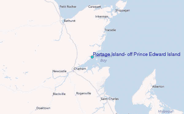