
| Distance / Altitude | Location | Report Date / Time | Live Weather | Wind | Gusts | Temp. | Visibility | Cloud |
|---|---|---|---|---|---|---|---|---|
| 3.1 miles NW / 33 ft | McDonald wx (United States) | 2025-03-16 19:49 local (2025/03/17 02:49 GMT) | light rain | wind obs. (32 kph from 95 degs) was rejected (- mph at -) | 53.6°F | - | - - 0 | |
| 6.8 miles SE / 79 ft | Point Reyes Station wx (United States) | 2025-03-16 19:39 local (2025/03/17 02:39 GMT) | light rain | wind obs. (19 kph from 129 degs) was rejected (- mph at -) | 53.6°F | - | - - 0 | |
| 11.2 miles S / 10 ft | BUOY-PRYC1 (Marine) | 2025-03-16 19:00 local (2025/03/17 02:00 GMT) | - (- mph at -) | — | - | |||
| 13.0 miles SE / 925 ft | Lagunitas (California) | 2025-03-16 19:39 local (2025/03/17 02:39 GMT) | light rain | wind obs. (10 kph from 249 degs) was rejected (- mph at -) | 50.0°F | - | - - 0 | |
| 14.3 miles NE / 308 ft | Cotati (California) | 2025-03-16 19:05 local (2025/03/17 02:05 GMT) | dry | light winds from the SSE (5 mph at 156) | 53.6°F | - | - - 0 | |
| 14.9 miles E / 217 ft | Novato (California) | 2025-03-16 19:24 local (2025/03/17 02:24 GMT) | dry | light winds from the SSE (5 mph at 159) | 53.6°F | - | - - 0 | |
| 15.5 miles NNE / 289 ft | Knowles Corner wx (United States) | 2025-03-16 19:02 local (2025/03/17 02:02 GMT) | light rain | calm (0 mph at 113) | 51.8°F | - | - - 0 | |
| 16.2 miles NNE / 226 ft | Alten wx (United States) | 2025-03-16 19:09 local (2025/03/17 02:09 GMT) | light rain | calm (5 mph at 216) | 51.8°F | - | - - 0 | |
| 16.8 miles ENE / 92 ft | Petaluma Municipal Airport (California) (California) | 2025-03-16 18:35 local (2025/03/17 01:35 GMT) | Mist - | light winds from the SSE.(Wind varies from 130 to 190 degs) (10 mph at 160) | 51.8°F | 6 | overcast | |
| 17.4 miles NW / 978 ft | Occidental (California) | 2025-03-16 19:41 local (2025/03/17 02:41 GMT) | light rain | wind obs. (6 kph from 200 degs) was rejected (- mph at -) | 48.2°F | - | - - 0 |
| Contours: | Roads & Rivers: | Select a
tide station / surf break / city |


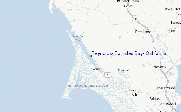
Use this relief map to navigate to tide stations, surf breaks and cities that are in the area of Reynolds, Tomales Bay, California.
Other Nearby Locations' tide tables and tide charts to Reynolds, Tomales Bay, California:
click location name for more details
 Surf breaks close to Reynolds, Tomales Bay, California:
|
||
|---|---|---|
| Closest surf break | Dillon Beach | 8 mi |
| Second closest surf break | Point Reyes Beach | 8 mi |
| Third closest surf break | Shark Pit | 8 mi |
| Fourth closest surf break | Drakes Bay | 9 mi |
| Fifth closest surf break | Drakes Estero | 9 mi |

 Nearest