
| Distance / Altitude | Location | Report Date / Time | Live Weather | Wind | Gusts | Temp. | Visibility | Cloud |
|---|---|---|---|---|---|---|---|---|
| 3.7 miles NE / 10 ft | BUOY-46122 (Marine) | 2025-03-14 18:30 local (2025/03/15 01:30 GMT) | light winds from the W (5 mph at 280) | 47.5°F | - | |||
| 17.4 miles SE / 10 ft | BUOY-BMTW1 (Marine) | 2025-03-14 19:48 local (2025/03/15 02:48 GMT) | light winds from the WNW (5 mph at 290) | — | - | |||
| 18.6 miles SSE / 1762 ft | Bremerton National Airport (Washington) | 2025-03-14 18:56 local (2025/03/15 01:56 GMT) | Light rain | light winds from the S (5 mph at 170) | 42.1°F | 16 | overcast | |
| 19.9 miles N / 121 ft | Port Townsend Airport (Washington) (Washington) | 2025-03-14 19:35 local (2025/03/15 02:35 GMT) | Dry and cloudy | calm (0 mph at 0) | 44.6°F | 16 | broken overcast | |
| 20.5 miles ESE / 10 ft | BUOY-WPOW1 (Marine) | 2025-03-14 20:00 local (2025/03/15 03:00 GMT) | - (0 mph at -) | 45.9°F | - | |||
| 24.2 miles N / 10 ft | BUOY-PTWW1 (Marine) | 2025-03-14 19:48 local (2025/03/15 02:48 GMT) | light winds from the SSE (5 mph at 150) | — | - | |||
| 24.9 miles ESE / 328 ft | Seattle (Washington) | 2025-03-14 19:02 local (2025/03/15 02:02 GMT) | - | wind obs. (16 kph from 128 degs) was rejected (- mph at -) | — | - | - - 0 | |
| 27.3 miles NW / 174 ft | Carlsborg wx (United States) | 2025-03-14 19:47 local (2025/03/15 02:47 GMT) | - | calm (0 mph at 287) | 44.6°F | - | - - 0 | |
| 27.3 miles NW / 102 ft | Sequim (Washington) | 2025-03-14 19:34 local (2025/03/15 02:34 GMT) | dry | wind obs. (13 kph from 89 degs) was rejected (- mph at -) | 46.4°F | - | - - 0 | |
| 28.6 miles ENE / 715 ft | Everett Airport (Washington) | 2025-03-14 18:53 local (2025/03/15 01:53 GMT) | Dry and cloudy | light winds from the S (10 mph at 170) | 46.9°F | 16 | broken overcast |
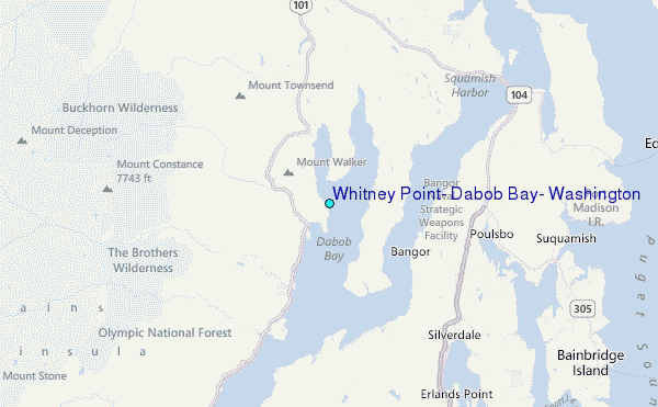
Choose Whitney Point, Dabob Bay, Washington Location Map Zoom:
| Contours: | Roads & Rivers: | Select a
tide station / surf break / city |


Use this relief map to navigate to tide stations, surf breaks and cities that are in the area of Whitney Point, Dabob Bay, Washington.
Other Nearby Locations' tide tables and tide charts to Whitney Point, Dabob Bay, Washington:
click location name for more details
 Surf breaks close to Whitney Point, Dabob Bay, Washington:
|
||
|---|---|---|
| Closest surf break | Super green | 32 mi |
| Second closest surf break | Fort. Ebey | 32 mi |
| Third closest surf break | Elwha | 42 mi |
| Fourth closest surf break | Crescent | 48 mi |
| Fifth closest surf break | Whiskey Creek | 51 mi |

 Nearest